
PhilPost launches “1734 Murillo Velarde map” stamp
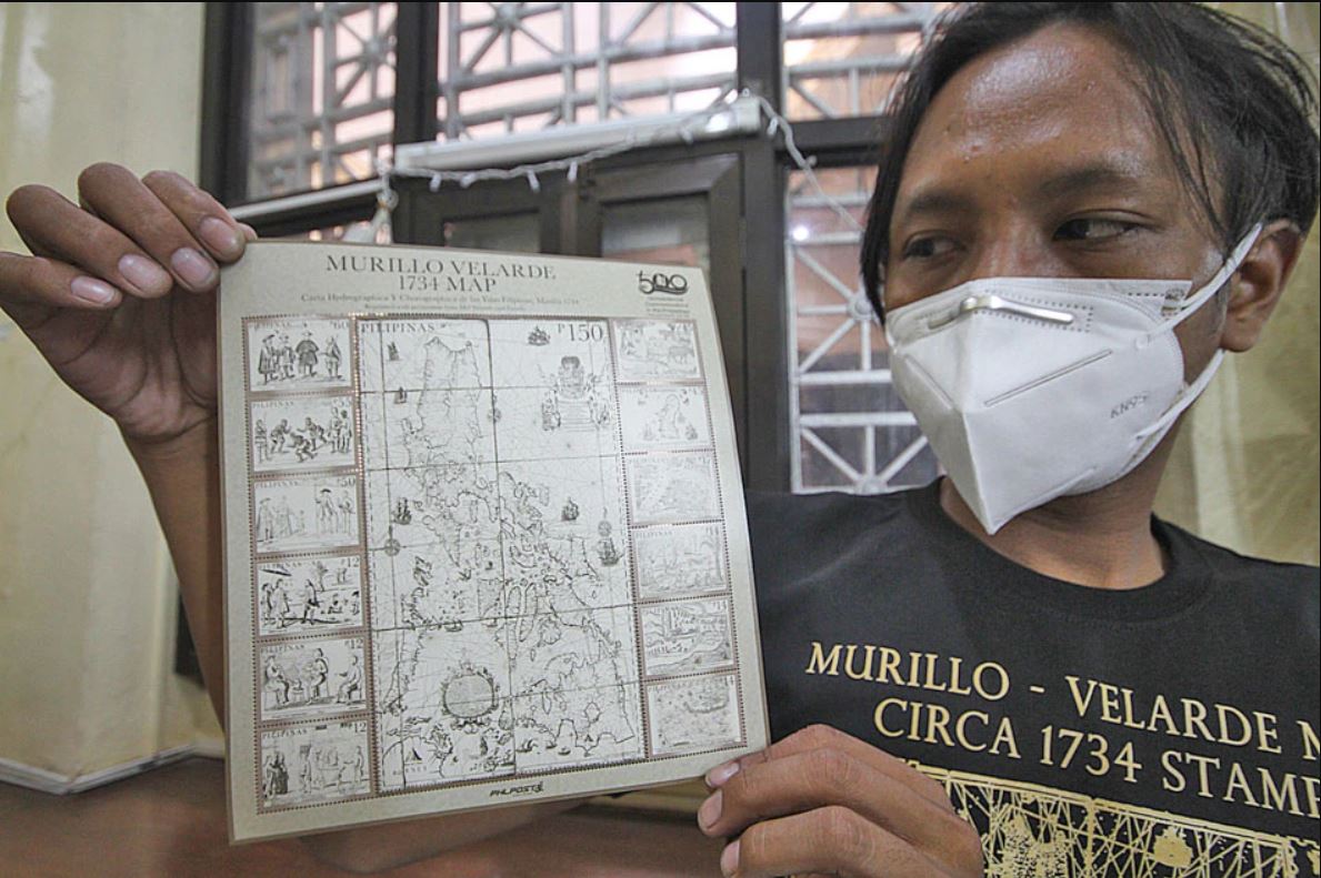

A Philippine Postal Corporation employee shows a 200mm x 220mm stamp of the 1734 Murillo Velarde map – the first scientific map of the Philippine archipelago – at the PhilPost office in Lawton, Manila City on Tuesday. The 300-year old map was used in the Hague proceedings to establish the territorial integrity of the West Philippine Sea. The stamp, titled “Murillo Velarde 1734 map-Carta Hydrographica de las Yslas Filipinas, Manila 1734,” is available at P150 each.